
2D & 3D Drone Mapping
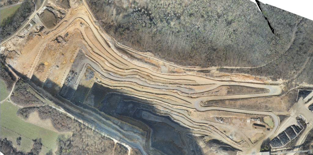
At Akshaya Aerospace, we specialize in delivering advanced 2D and 3D drone mapping solutions powered by drones and modern photogrammetry technologies. Our mapping services provide accurate, high-resolution, and data-rich visualizations that are essential for industries ranging from agriculture and construction to urban planning and infrastructure management.
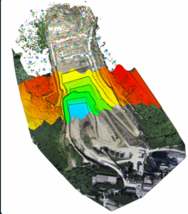
Using state-of-the-art drones equipped with high-resolution sensors and RTK/PPK positioning systems, we capture detailed aerial imagery that is processed into precise georeferenced maps and 3D models. These outputs empower businesses and organizations to make informed decisions, monitor progress, and plan with confidence.
Our Capabilities Include:
• 2D Orthomosaic Maps: High-resolution stitched images providing clear, bird’s-eye views for land surveys, property assessments, and large-scale monitoring.
• 3D Models & Digital Twins: Accurate 3D reconstructions of terrain, buildings, and infrastructure for design validation, structural analysis, and virtual visualization.
• Topographic Mapping & Contour Generation: Detailed elevation models that support civil engineering, mining, and flood-risk analysis.
• Construction & Infrastructure Monitoring: Track project progress with time-based mapping comparisons, reducing errors and improving efficiency.
• Agriculture & Land Use Mapping: Create NDVI and vegetation health maps for precision farming and crop management.
Why Choose Our Drone Mapping Solutions?
• High Accuracy: Enhanced with GNSS-based corrections for centimeter-level precision.
• Cost-Effective & Scalable: Large areas mapped quickly and at a fraction of the cost of traditional surveying methods.
• Custom Deliverables: Outputs compatible with CAD, GIS, and BIM software for easy integration into existing workflows.
• Versatile Applications: Useful across industries including real estate, mining, utilities, forestry, disaster management, and smart city planning.
By combining aerial intelligence with advanced processing software, we deliver mapping solutions that are not only visually powerful but also technically precise. At Akshaya Aerospace, we aim to bridge the gap between raw aerial data and practical, actionable insights that transform how industries manage land, infrastructure, and resources.